| Holiday 1997 in Iceland |
Tipping
Service is invariably included in all prices for restaurants, hotels,
taxis, hairdressers etc. Tipping is therefore not customary in Iceland.
The people
The Icelanders are of Scandinavian origin, with some early blending of
Celtic blood. The total population is 267,809 (as of Dec. 1, 1995), of
which more than 59% now live in Reykjavík and surrounding towns.
Names
Only about 10% of Icelanders have surnames or family names. The rest use
the system of patronymics, i.e. instead of a surname the first name of
the father is used, with "son" or "dóttir" (daughter) added to it.
Thus Jónsson means the son of Jón, and Halldórsdóttir
means the daughter of Halldór. People address one another by their
first names. The telephone directory lists people by their first names.
Clothes
When travelling in Iceland you should bring along lightweight woollens, a
sweater or cardigan, a rainproof (weather-proof) coat and sturdy walking
shoes. Also bring your swimming suit. Travellers who are camping or
heading into the interior will need warm underwear socks, rubber boots
and a warm sleeping-bag.
Weather
Thanks to the Gulf Stream, Iceland enjoys a cool temperature ocean
climate: cool in summer and fairly mild in winter. However, the weather
is very unpredictable and tourists should be prepared for the unexpected.
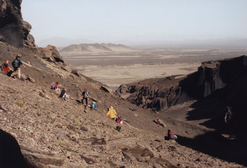
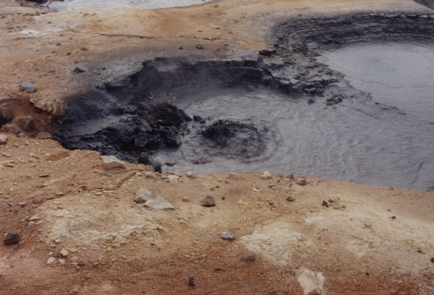
Krísuvík
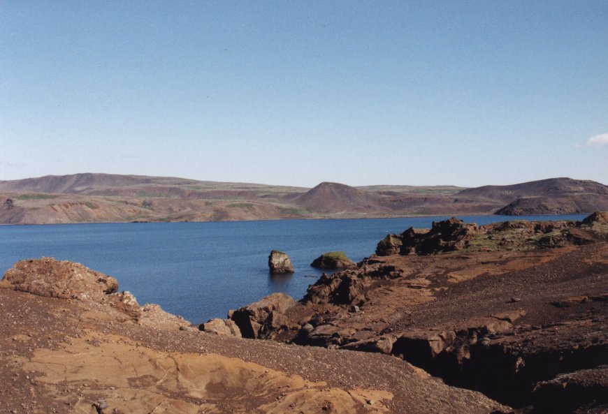
 A geothermal area by Kleifarvatn lake, where blowing steamholes and
bubbling mud pools can be inspected at close range.
A geothermal area by Kleifarvatn lake, where blowing steamholes and
bubbling mud pools can be inspected at close range.
Bláa línið
The Blue Lagoon, the pearl of Reykjanes, is the main tourist attraction
in thie area, if not in the country. Formed by natural runoff water
from the Svartsengi power plant, dark blue in colour - sometimes
clouded with mighty columns of steam whirling off the plant's pressure
pipes - it is the perfect setting for the swim of your lifetime.
Krísuvíkurberg
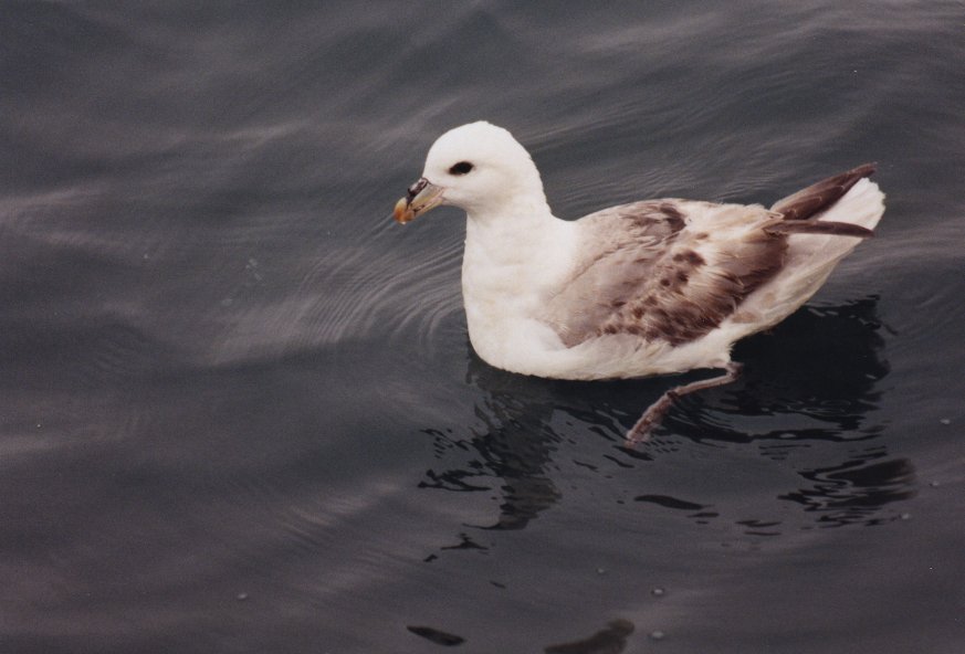
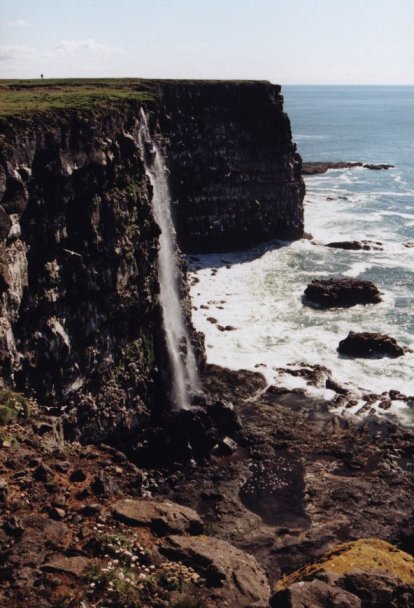 The Reykjanes area abounds with accessible bird cliffs and is therefore
prime terrain for birdwatchers. Some of the most impressive spots
are Krísuvíkurberg cliff and Hafnaberg. You can see lost of
birds nesting on the cliffs like stormy petrels and puffins.
The Reykjanes area abounds with accessible bird cliffs and is therefore
prime terrain for birdwatchers. Some of the most impressive spots
are Krísuvíkurberg cliff and Hafnaberg. You can see lost of
birds nesting on the cliffs like stormy petrels and puffins.
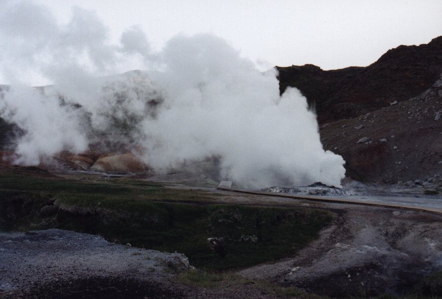
Geysir
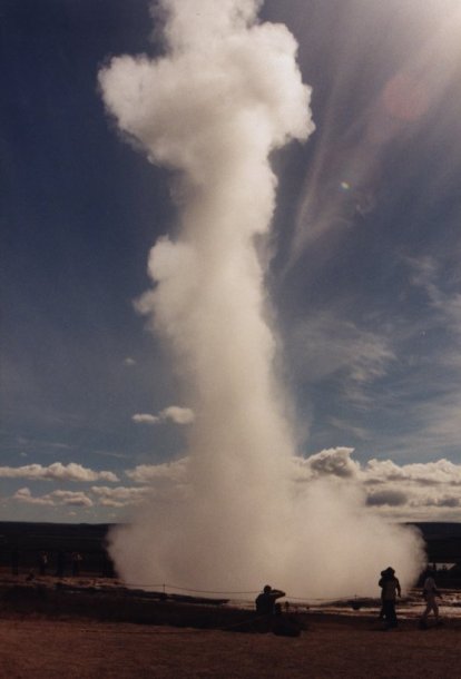
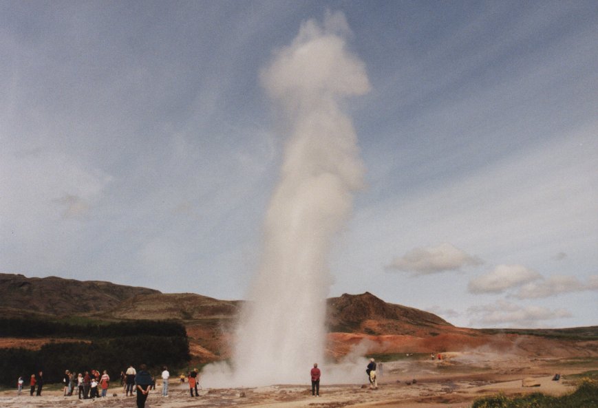 The worlds largest geyser, whose name (meaning "Gusher") is the generic
term for this strange phenomenon. Geysir, believed to have been formed
in the thirteenth century, is a bowl 18 m in diameter with a 20-meter-deep
chamber below. Its eruptions are majestic but increasingly rare in
recent times, although the keepers of the site do induce dramatic
spoutings on certain occasions.
The worlds largest geyser, whose name (meaning "Gusher") is the generic
term for this strange phenomenon. Geysir, believed to have been formed
in the thirteenth century, is a bowl 18 m in diameter with a 20-meter-deep
chamber below. Its eruptions are majestic but increasingly rare in
recent times, although the keepers of the site do induce dramatic
spoutings on certain occasions.
A smaller, adjacent hot spring, Strokkur,
is a popular attraction, erupting at 5-10 minute intervals. The whole
area contains a variery of hot springs and bubbling pools.
Gullfoss
"Golden Waterfall", renowned for its breathtaking beauty. This mighty
two-tiered-cataract creates a majestic spectacle as it thunders 32 m
over a fault into a gorge which measures 2.5 km in length and up to 70 m
deep in places.
Kerið
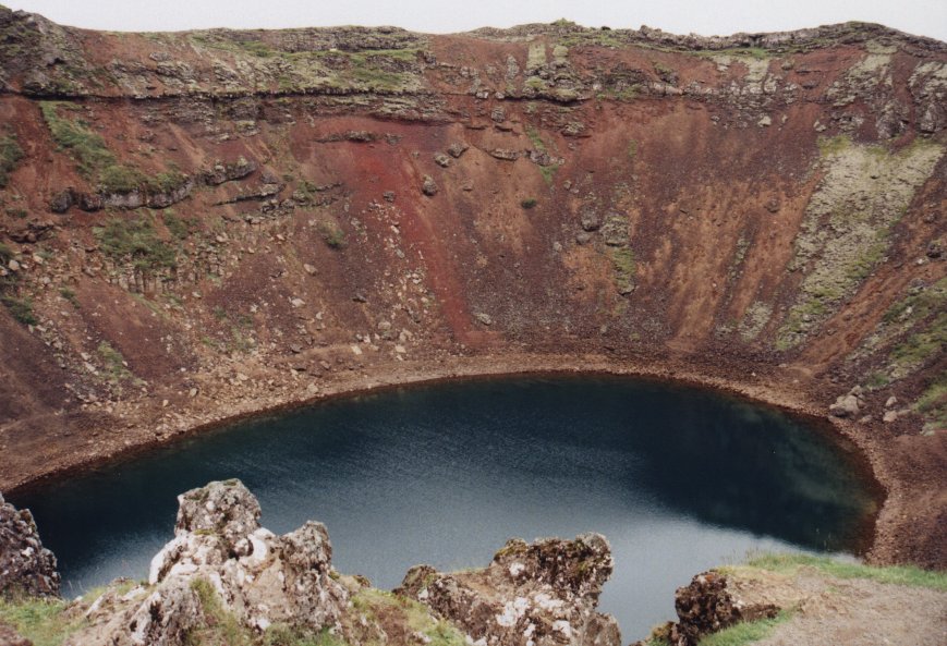 Beautifully formed crater, 55 m deep and with a blue pool at its bottom.
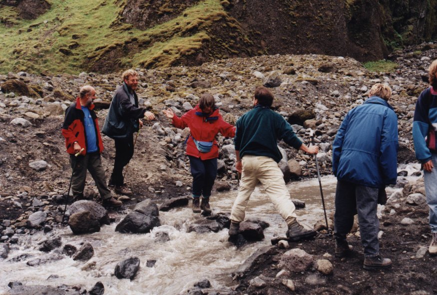
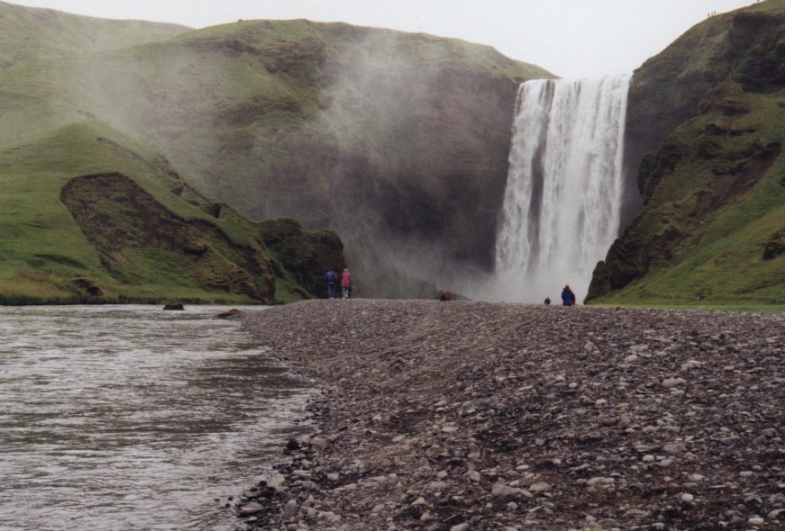
Seljalandsfoss
Picturesque waterfall, 40 m high. A path lies at the bottom of the
cliff where it cascades down, offering a safe and easy opportunity to
walk behind the waterfall to the other side.
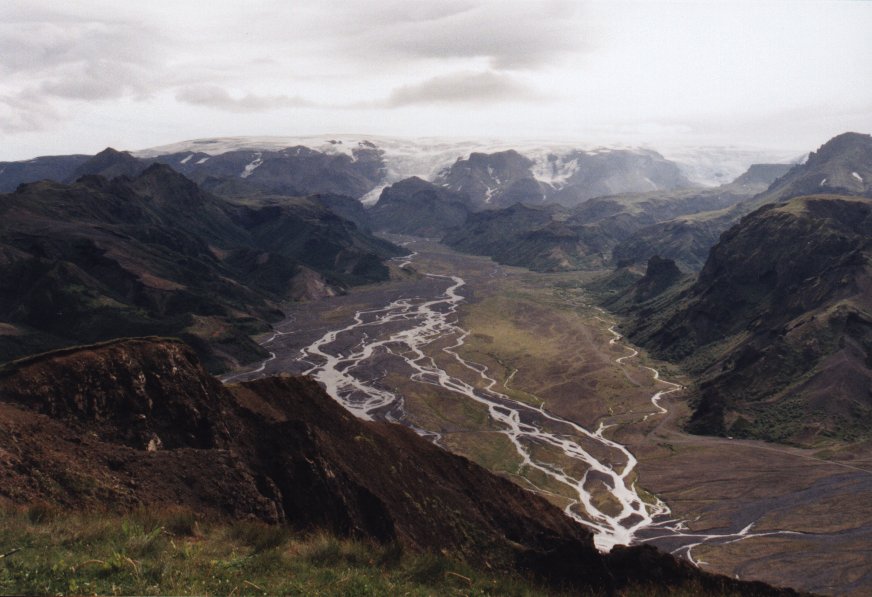
Þórsmörk
 Beautiful nature reserve partially hidden among the three glaciers
Eyjafjallajökull, Mýrdalsjökull and Tindfjallajökull.
There are countless small valleys, fine birch woods, glacial rivers,
crystal-clear brooks and magnificent mountain scenery.
Beautiful nature reserve partially hidden among the three glaciers
Eyjafjallajökull, Mýrdalsjökull and Tindfjallajökull.
There are countless small valleys, fine birch woods, glacial rivers,
crystal-clear brooks and magnificent mountain scenery.
 Some tourist
huts are available, along with a camping ground and endless opportunities
for hiking.
Some tourist
huts are available, along with a camping ground and endless opportunities
for hiking.
Skógar
 Beautiful natural surroundings, a nice folk museum (male visitors beware
of the owner) and summer accomodation facilities make this a popular
tourist resort. Skógafoss waterfall, 60 m high, is one of the
most impressive in the area. On top of the mountains overlooking the area
is the glacier Eyjafjallajökull, whose peak of 1666 m is the
highest point in south Iceland.
Beautiful natural surroundings, a nice folk museum (male visitors beware
of the owner) and summer accomodation facilities make this a popular
tourist resort. Skógafoss waterfall, 60 m high, is one of the
most impressive in the area. On top of the mountains overlooking the area
is the glacier Eyjafjallajökull, whose peak of 1666 m is the
highest point in south Iceland.
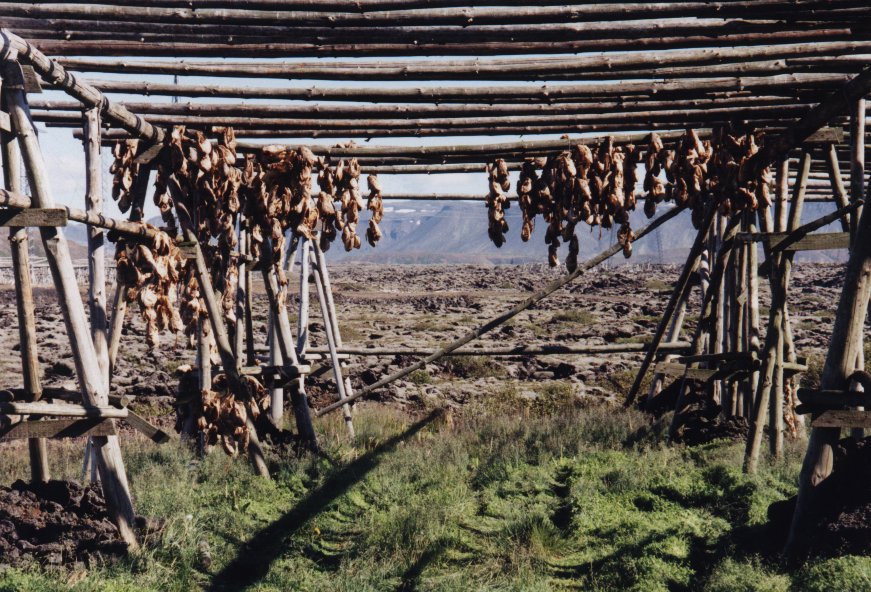 The picture on the left shows a wooden rack where fish is drying.
Mýrdalsjökull
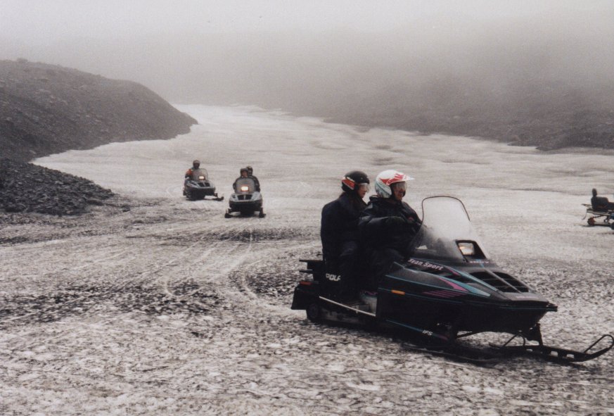
A large glacier, 1493 m highand about 600 square km in area. Beneath
the ice is the mighty volcano Katla, which last erupted in 1918.
Snowmobile hire and hiking trips can be arranged at the glacier.
You will go with a Bigfoot truck into the glacier where you first get
a briefing and then experience a fantastic ride. When I was there it
was a bit foggy, which made the ride even more spectacular.
Dverghamrar
"Dwarfs' Cliffs", two clusters of peculiar basalt culumns.
 Generally recognized as having the mildest climate in the country,
the east region boasts some of the richest vegetation and woodlands
in Iceland. Hallormssatðarskógur near the regional "capital"
Egilsstaðir is Iceland's only real forrest, while Skaftafell National
Park, nestling against the glacier and dominated by the country's
highest mountain (Öræfajökull, 2117 m) contains both thick
birchwoods and a wealth of localized plants.
Generally recognized as having the mildest climate in the country,
the east region boasts some of the richest vegetation and woodlands
in Iceland. Hallormssatðarskógur near the regional "capital"
Egilsstaðir is Iceland's only real forrest, while Skaftafell National
Park, nestling against the glacier and dominated by the country's
highest mountain (Öræfajökull, 2117 m) contains both thick
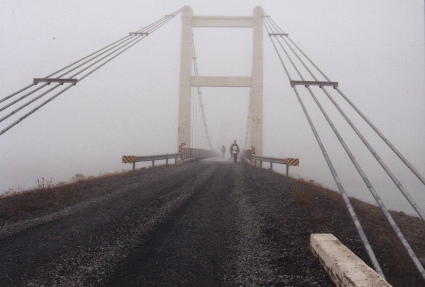
birchwoods and a wealth of localized plants.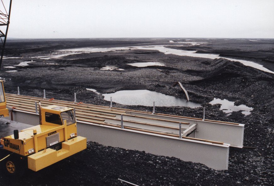 Towards the southeast from Höfn to beyond Skaftafell it has shaped the
coast with heavy deposits of black sand, and its many glacial tongues are
visible along a long stretch of the Ring Road. The pictue shows the
construction of a new bridge after it had been teared apart by blocks of ice
coming down Vatnajökull when a volcano under this glacier erupted just a
few months earlier.
Towards the southeast from Höfn to beyond Skaftafell it has shaped the
coast with heavy deposits of black sand, and its many glacial tongues are
visible along a long stretch of the Ring Road. The pictue shows the
construction of a new bridge after it had been teared apart by blocks of ice
coming down Vatnajökull when a volcano under this glacier erupted just a
few months earlier.
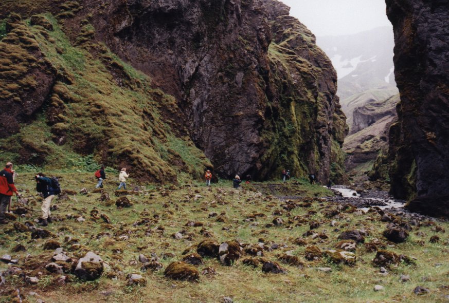
Skaftafell National Park
Towering mountains, imposing glaciers, gulches with clear brooks and
beautiful waterfalls, birch woods, a wealth of wild flowers and lush
vegitation. A walk on the marked paths along the gulches for a look at
the waterfalls is a must for all the park's numerous visitors. The most
majestic is Svartifoss. "Black Falls", plunging over a wall of symmetrical
columnar baslt that recalls organ pipes. Places to explore on longer
hikes include Sjónsker for a commanding view and Mórsàrdalur
valley with its fine birch forest Bæjarstaðaskógur.
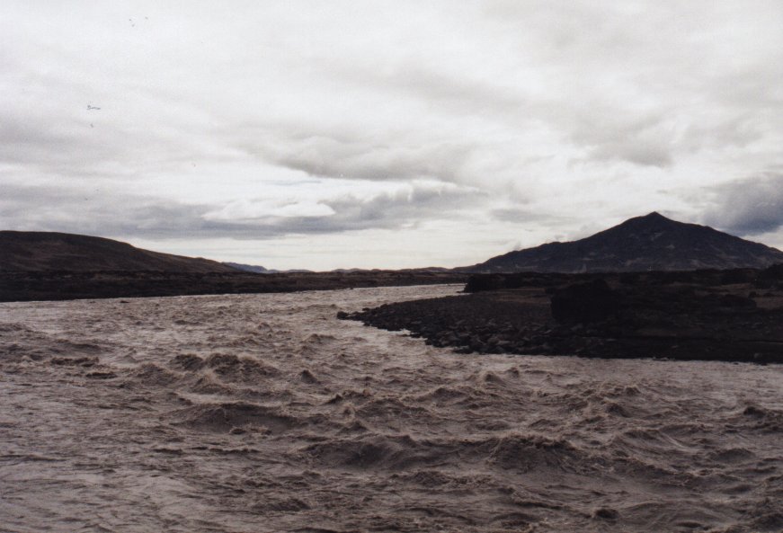
Skeiðaràrsandur
 The largest sand desert in Iceland, about 1000 square km, formed by
vast deposits from glaciers and volcanic activity under the
Vatnajökull cap. Not bridged until 1974, when the final stretch
of the Ring Road around Iceland was completed to coincide with the
1100th anniversary of the settlement.
The largest sand desert in Iceland, about 1000 square km, formed by
vast deposits from glaciers and volcanic activity under the
Vatnajökull cap. Not bridged until 1974, when the final stretch
of the Ring Road around Iceland was completed to coincide with the
1100th anniversary of the settlement.
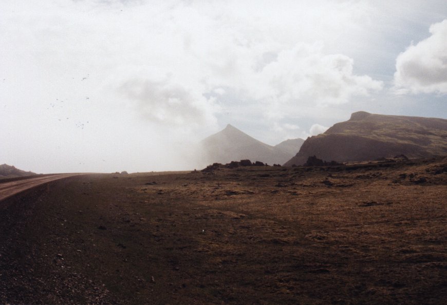
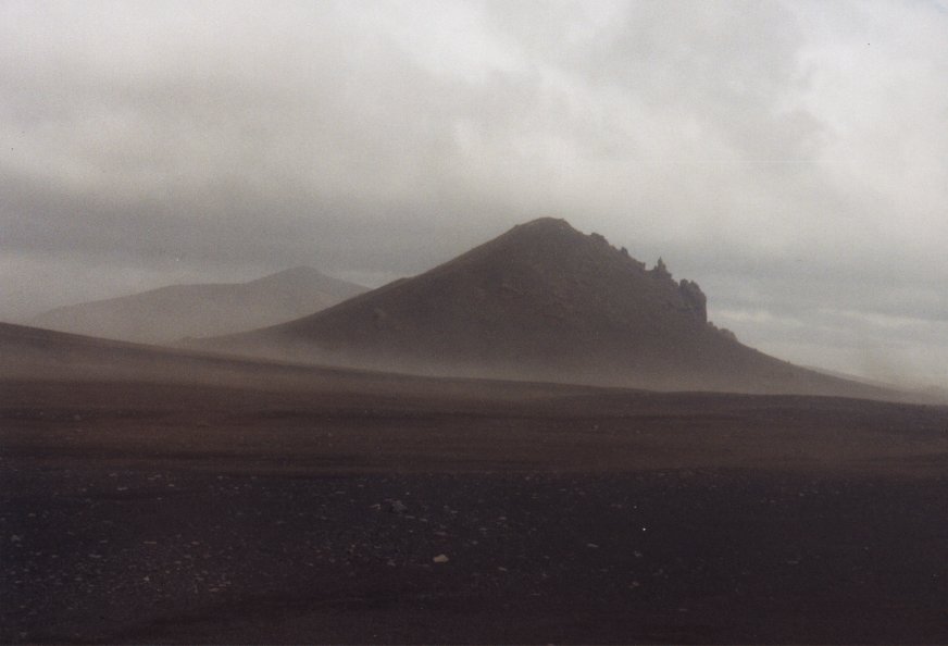
On the picture a sandstorm is visible.
Ingólfshöfði
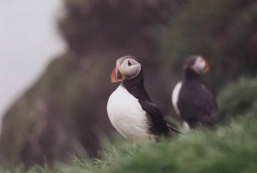
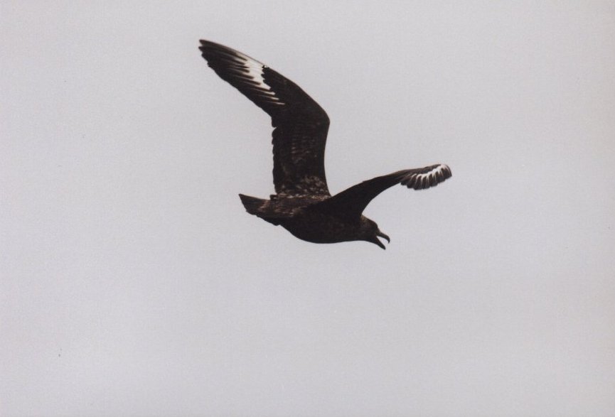
The single small mountain on the coast with its high bird cliffs
is Ingólfshöfði (150 m), named after the first settler
of Iceland, Ingólfur Arnarson, who spend his first winter in the area.
Thousands of puffins have nests on the cliffs. These birds are not scared at
all, you can approach them quite close. Unlike some hunting birds, but be
aware that they can attack you if you enter their territory. Also mountain goats
can been seen here.
Jökulsàrlón on Breiðurmerkursandur
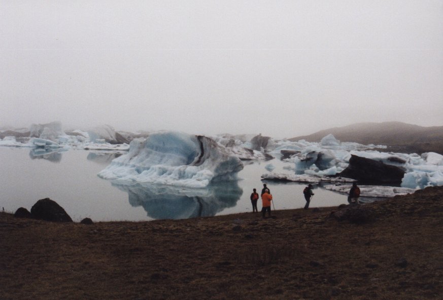
 A fantastic 160 metre-deep glacial lagoon. At its upper end, the glacier
occasionally calves icebergs which float around in the lagoon. The ice
from the glacier is over 1000 years old, but the lagoon has largly been
formed this century as the glaciers retreats in the warmer climate.
A very popular sightseeing attraction, widely regarded as the most
picturesque scenery in all of south Iceland. When we were there a thick fog was
present at some places.
A fantastic 160 metre-deep glacial lagoon. At its upper end, the glacier
occasionally calves icebergs which float around in the lagoon. The ice
from the glacier is over 1000 years old, but the lagoon has largly been
formed this century as the glaciers retreats in the warmer climate.
A very popular sightseeing attraction, widely regarded as the most
picturesque scenery in all of south Iceland. When we were there a thick fog was
present at some places.
Höfn in Hornafjörður
 Höfn in Hornafjörður is a burstling fishing and fish
processing port as well as a commercial centre, with considerable farming
in the neighbouring area, and has grown rapidly in recent decades.
Since the completion of the Ring Road in 1974, Höfn has enjoyed
excellent communication links with the rest of Iceland.
Höfn in Hornafjörður is a burstling fishing and fish
processing port as well as a commercial centre, with considerable farming
in the neighbouring area, and has grown rapidly in recent decades.
Since the completion of the Ring Road in 1974, Höfn has enjoyed
excellent communication links with the rest of Iceland.
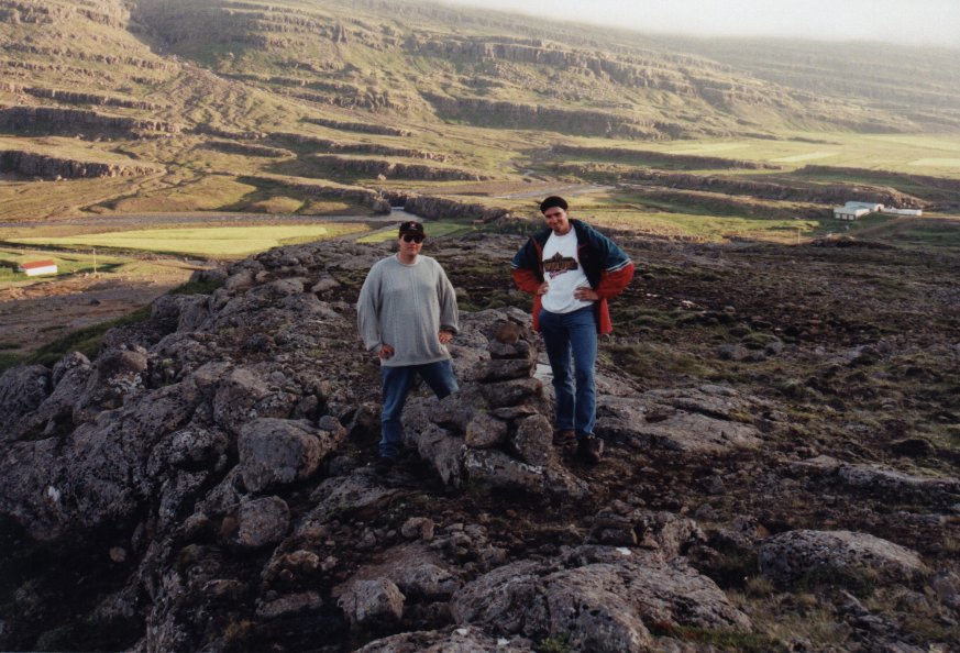 Marco and I build a nice stoneman near the farm where we were staying. Stonemen were
made as landmarks when there were no proper roads. It is only made of rocks piled
up. Some of these creations are more than a meter high.
Marco and I build a nice stoneman near the farm where we were staying. Stonemen were
made as landmarks when there were no proper roads. It is only made of rocks piled
up. Some of these creations are more than a meter high.
Points to remember:
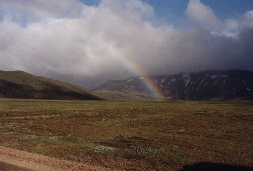
Öskjuleið
 Öskjuleið, the route to the Askja volcano, turns from the
Ring Road (main road no. 1) between Mývatnssveit and
Grísstaðir, just west of the river Jökulsa à Fjöllum.
The road to Askja continues southwards through Drekagil. Akureyri
Touring Club has set up huts and a campsite at Drekagil, and a warden is
on duty there during the summer.
Öskjuleið, the route to the Askja volcano, turns from the
Ring Road (main road no. 1) between Mývatnssveit and
Grísstaðir, just west of the river Jökulsa à Fjöllum.
The road to Askja continues southwards through Drekagil. Akureyri
Touring Club has set up huts and a campsite at Drekagil, and a warden is
on duty there during the summer.
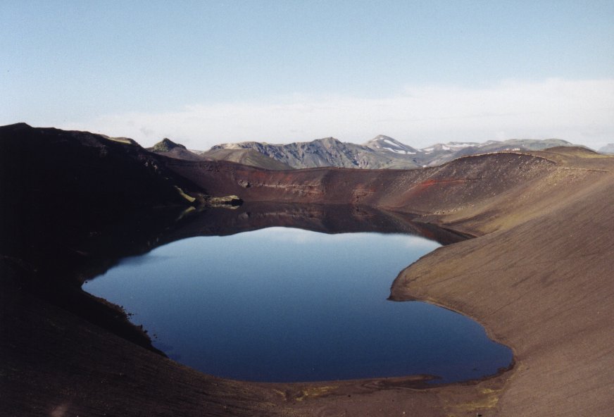
Askja
Askja is a caldera in the Dyngjufjöll mountains, a cental volcano
that has been piling up above Ódaðahraun lava field for
hundreds of thousands of years and now covers an area of some 250 square
km. Ódaðahraun means "lavafield of criminals". Many criminals
were send into this area as a punishment. Most of them died of
starvation or because of the cold. It was allowed to to kill each other.
This was done to prevent people to form outlaw gangs. If you had killed
three outlaws you could return to normal society. Or you had to wait
twenty years before you had served your time.
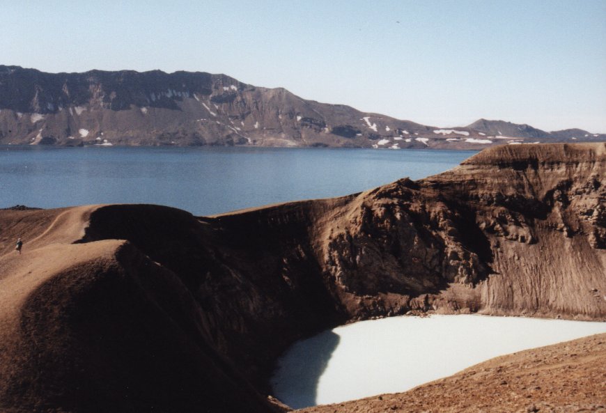 Around 50 square km of this area has sunk to form a caldera at Askja,
whose bottom is at an altitude of about 1150 m above sea level. During
an eruption in 1875, an area of 11 square km on the southeastern side
of Askja caved in to form Lake Öskjuvatn, the deepest lake in
Iceland (1050 m), and a crater known as Víti (Hell) north of it.
At this lake I proved my Viking spirit by jumping bare naked into the
ice-cold water.
Around 50 square km of this area has sunk to form a caldera at Askja,
whose bottom is at an altitude of about 1150 m above sea level. During
an eruption in 1875, an area of 11 square km on the southeastern side
of Askja caved in to form Lake Öskjuvatn, the deepest lake in
Iceland (1050 m), and a crater known as Víti (Hell) north of it.
At this lake I proved my Viking spirit by jumping bare naked into the
ice-cold water.
 One one day we went with the bus into a desert. Although the warden said it was easy
to travel there we got stuck with the bus in the sand. Most people in the group hiked
back to the campground, while Jon, Bonne and me tried to dig out the bus. We almost
succeeded but it was just too much. A four-wheel drive pulled us out.
One one day we went with the bus into a desert. Although the warden said it was easy
to travel there we got stuck with the bus in the sand. Most people in the group hiked
back to the campground, while Jon, Bonne and me tried to dig out the bus. We almost
succeeded but it was just too much. A four-wheel drive pulled us out.
 East of the Askja is a place where astronauts practised hiking in a remote
area during the Apollo missions. They say that this site resembles a bit
parts of the moon.
East of the Askja is a place where astronauts practised hiking in a remote
area during the Apollo missions. They say that this site resembles a bit
parts of the moon.
Herðubreiðarlindir
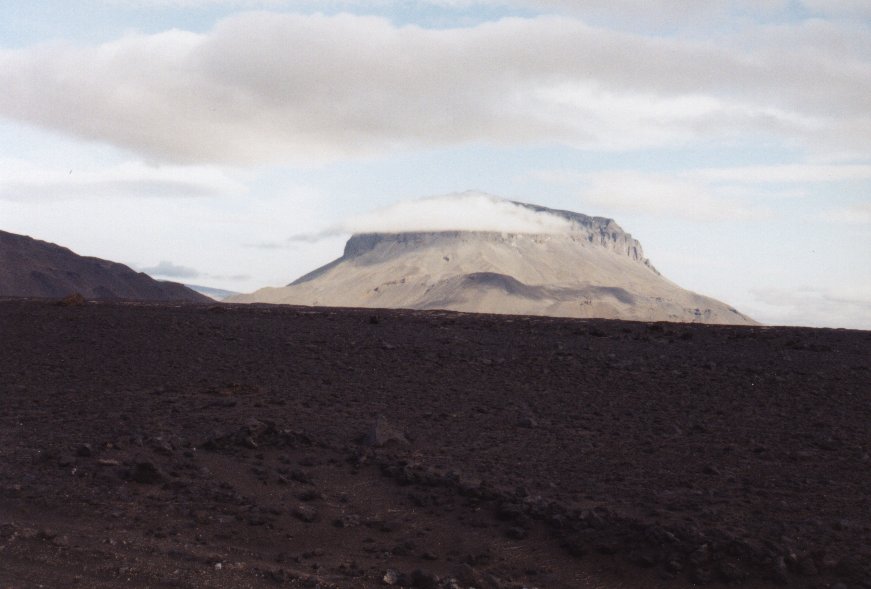 Another "oasis" with with much vegetation cover lying northeast of
Mt. Herðubreið. Numerous springs issue from the Lindahraun
lava field to form the river Lindaá, which subsequently drains
into Jökulsá. From the springs there is a view to
Mt. Herðubreið (1682 m), a wonderfully symmetrical table
mountain which is often cited as a classic example of this type of
volcanic formation. The first confirmed ascent of Herðubreið
was in 1908.
Another "oasis" with with much vegetation cover lying northeast of
Mt. Herðubreið. Numerous springs issue from the Lindahraun
lava field to form the river Lindaá, which subsequently drains
into Jökulsá. From the springs there is a view to
Mt. Herðubreið (1682 m), a wonderfully symmetrical table
mountain which is often cited as a classic example of this type of
volcanic formation. The first confirmed ascent of Herðubreið
was in 1908.
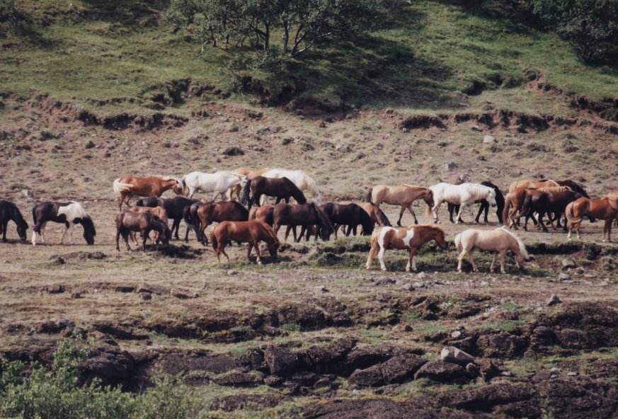
 We stayed at a school (Skolabrekka) near Mývatn for a few days and
used it as a base camp to explore the northern part of the island. On one
of these days Bram and I prepared a typical Icelandic dinner. Shopping for these
goods was already big fun. Most people tried everything and it was a day not to
forget. Items that were available included boiled sheep head (I ate the nose and lips),
an Icelandic form of haggish (boiled sheep stomach filled with intestines), fish balls,
cured shark, puffins and freshly smoked salmon.
We stayed at a school (Skolabrekka) near Mývatn for a few days and
used it as a base camp to explore the northern part of the island. On one
of these days Bram and I prepared a typical Icelandic dinner. Shopping for these
goods was already big fun. Most people tried everything and it was a day not to
forget. Items that were available included boiled sheep head (I ate the nose and lips),
an Icelandic form of haggish (boiled sheep stomach filled with intestines), fish balls,
cured shark, puffins and freshly smoked salmon.
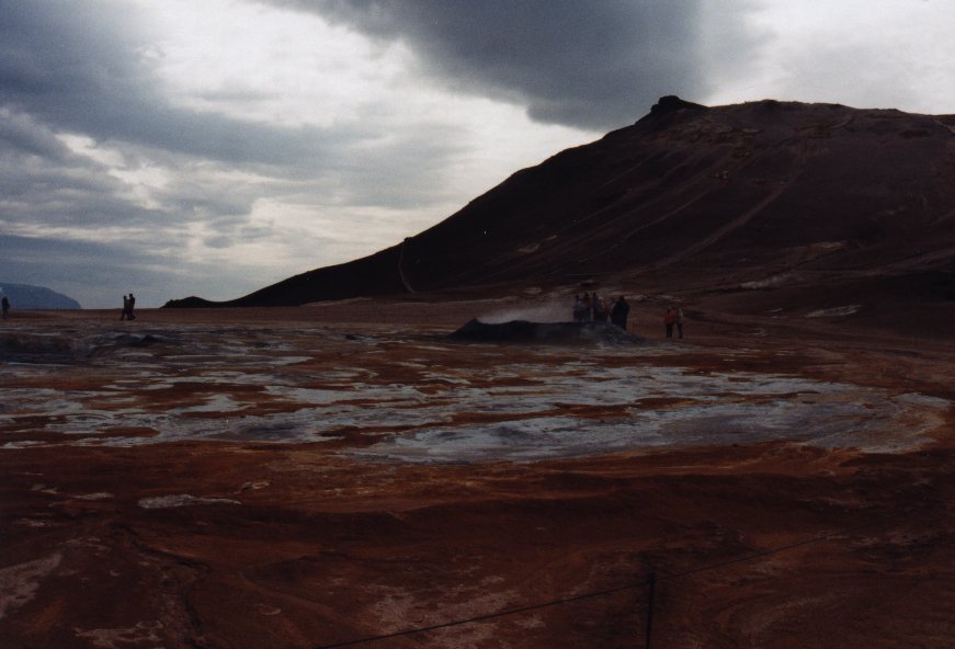
Krafla
High-temperature field with active volcanic craters. A steam-powered
electricity generating station has been built at Krafla.
Mývatn
 Among the largest lakes in Iceland. A variety of natural phenomena awaits
the visitor: rich bird life, varied flora, lava formations, lava caves,
traces of recent volcanic activity, geothermal fields, and the beautiful
Lake Mývatn itself. The Mývatn village by the lake has developed
in recent decades, partly around a diatomite factory, and also to provide
services for tourists from all over the world.
Among the largest lakes in Iceland. A variety of natural phenomena awaits
the visitor: rich bird life, varied flora, lava formations, lava caves,
traces of recent volcanic activity, geothermal fields, and the beautiful
Lake Mývatn itself. The Mývatn village by the lake has developed
in recent decades, partly around a diatomite factory, and also to provide
services for tourists from all over the world.
Jökulsárgljúfur (National Park)
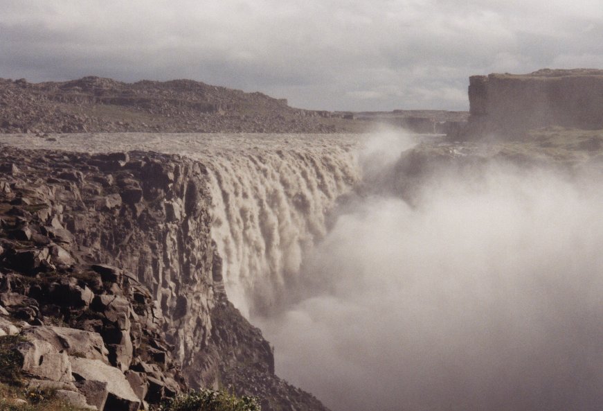
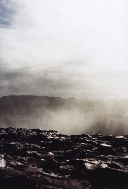
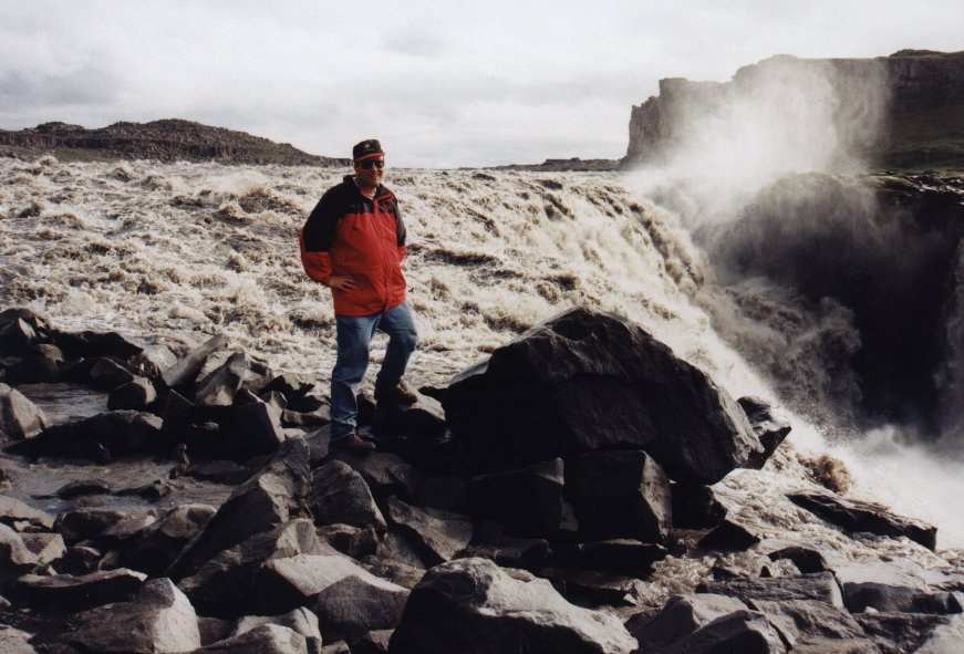
The largest and most rugged gorges anywhere in Iceland, through which
flows Jökulsá, one of the country's mighty glacial rivers.
In the gorge is Dettifoss, Europe's most powerful waterfall, contrasting
strikingly with the smaller falls of Hafragilsfoss and Selfoss.
 Among remarkable spots in the Jökulsá National Park are Ásbyrgi,
a natural horseshoe-shaped rock enclosure, whose impressive walls
reach a height of 90 metres, sheltering fertile and lush vegetation,
and Hljóðaklettar, a great labyrinth of crags and rock formations.
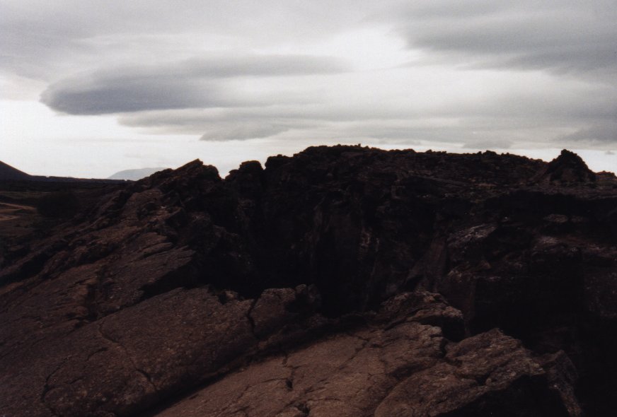
The picture shows a big crack in the earth crust. Clearly two different
tectonic plates are visible here. Iceland is basically divided by two of these
plates that cut the island into two parts.
Among remarkable spots in the Jökulsá National Park are Ásbyrgi,
a natural horseshoe-shaped rock enclosure, whose impressive walls
reach a height of 90 metres, sheltering fertile and lush vegetation,
and Hljóðaklettar, a great labyrinth of crags and rock formations.
The picture shows a big crack in the earth crust. Clearly two different
tectonic plates are visible here. Iceland is basically divided by two of these
plates that cut the island into two parts.
Goðafoss
"Fall of the Gods". One of Iceland's most renowned waterfalls.
Húsavík
 Húsavík is the commercial centre for a large agricultural
area, a busy fishing port and export harbour. Húsavík received
its name (House Bay) because of the houses built by the Swedish viking
Garðar Svavarsson when he spent one winter there while exploring
Iceland, before the settlement began. Húsavík attained
municipal status in 1950.
Húsavík is the commercial centre for a large agricultural
area, a busy fishing port and export harbour. Húsavík received
its name (House Bay) because of the houses built by the Swedish viking
Garðar Svavarsson when he spent one winter there while exploring
Iceland, before the settlement began. Húsavík attained
municipal status in 1950.
Growing numbers of tourists are visiting Húsavík every year,
taking advantage of its prime location as a base for touring the many
natural wonders of the two Þingeyjar districs. The church in
Húsavík is an unusual building that travellers should not
forget to visit.
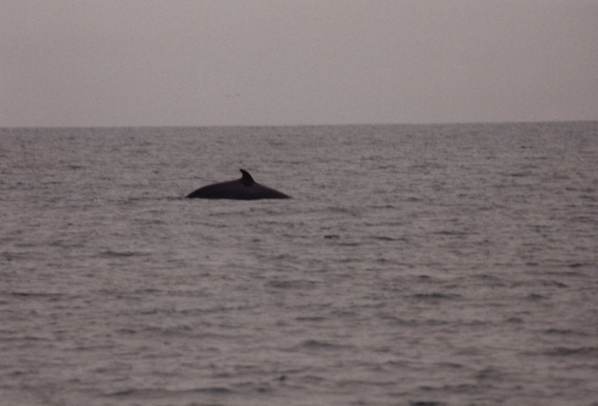 Above Húsavík is Mt. Húsavíkurfjall, whose top can be
reached by road to enjoy a splendid view. Hot water from the Hveravellir
springs in Reykjahverfi heats the houses in Húsavík. It is also
one of the best spots in Iceland to do some whale-watching. I have
seen about 15 Minke wales during a trip.
Above Húsavík is Mt. Húsavíkurfjall, whose top can be
reached by road to enjoy a splendid view. Hot water from the Hveravellir
springs in Reykjahverfi heats the houses in Húsavík. It is also
one of the best spots in Iceland to do some whale-watching. I have
seen about 15 Minke wales during a trip.
Tjörnes
Peninsula between the bays of Skjálfandi and Öxarfjörður,
with remarkable strata from the Ice Age and the Tertiary period.
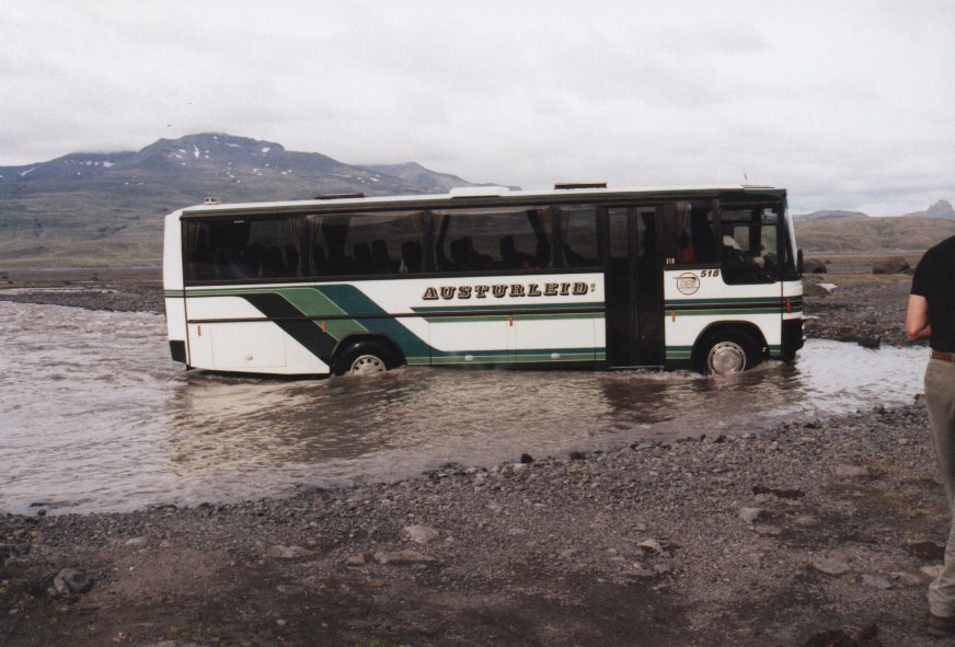
 With its unbridged rivers, Sprengisandur is only safe for well-equipped
4x4 vehicles. The road is open at early july.
With its unbridged rivers, Sprengisandur is only safe for well-equipped
4x4 vehicles. The road is open at early july.
Nýidalur
 The route passes through the valley Nýidalur (Jökuldalur),
800 m above sealevel, a location of what is thought to be one of the
highest continuous patches of vegetation in Iceland. A Touring Club
mountain hut is in the valley.
The route passes through the valley Nýidalur (Jökuldalur),
800 m above sealevel, a location of what is thought to be one of the
highest continuous patches of vegetation in Iceland. A Touring Club
mountain hut is in the valley.
Lake Þórisvatn
The Sprengisandur road continues to Lake Þórisvatn, which today
serves as a reservoir for the Tungnaá and Þjórsá
hydropower stations. Originally the lake measured 70 square km
in area, but at its highest water level it can now cover up to 83 square
km after the Köldukvísl diversion was channelled into it in 1971.
Þjórsárdalur
 Today only two farms remain in the vally. During the old commonwealth,
the valley had an estimated 20 farms, but most were destroyed by an
eruption in Hekla in 1104. The ruins of the Stöng farmhouse
well inside the valley were excavated in 1939, and preserved under
cover as a particularly good example of farmhouse layout from the
Saga Age. Later, they were used as a model for the Saga Age
farmstead reconstruction (Þjóðveldisbærinn) near the
old land of Skeljastaðir.
Today only two farms remain in the vally. During the old commonwealth,
the valley had an estimated 20 farms, but most were destroyed by an
eruption in Hekla in 1104. The ruins of the Stöng farmhouse
well inside the valley were excavated in 1939, and preserved under
cover as a particularly good example of farmhouse layout from the
Saga Age. Later, they were used as a model for the Saga Age
farmstead reconstruction (Þjóðveldisbærinn) near the
old land of Skeljastaðir.
 Beautiful explosion crater filled with water. Probably formed during the
16th century. The name means "Ugly pond" which I don't understand.
They say the lake contains a lot of trout. A small road leads to the
edge of the crater. By foot you can walk around the crater lake. After
this spectacular view you can walk to Landmannalaugar via the mountain
hiking trail or the trail at the bottom of the mountain next to the
lake Frostadavatn.
Beautiful explosion crater filled with water. Probably formed during the
16th century. The name means "Ugly pond" which I don't understand.
They say the lake contains a lot of trout. A small road leads to the
edge of the crater. By foot you can walk around the crater lake. After
this spectacular view you can walk to Landmannalaugar via the mountain
hiking trail or the trail at the bottom of the mountain next to the
lake Frostadavatn.
Landmannalaugar
A very active geothermal area in the interior, along a valley
surrounded by steep and colourful mountains. There are warm rivers and pools
to swim and bathe in, some excellent hiking trails and magnificient
natural phenomena.
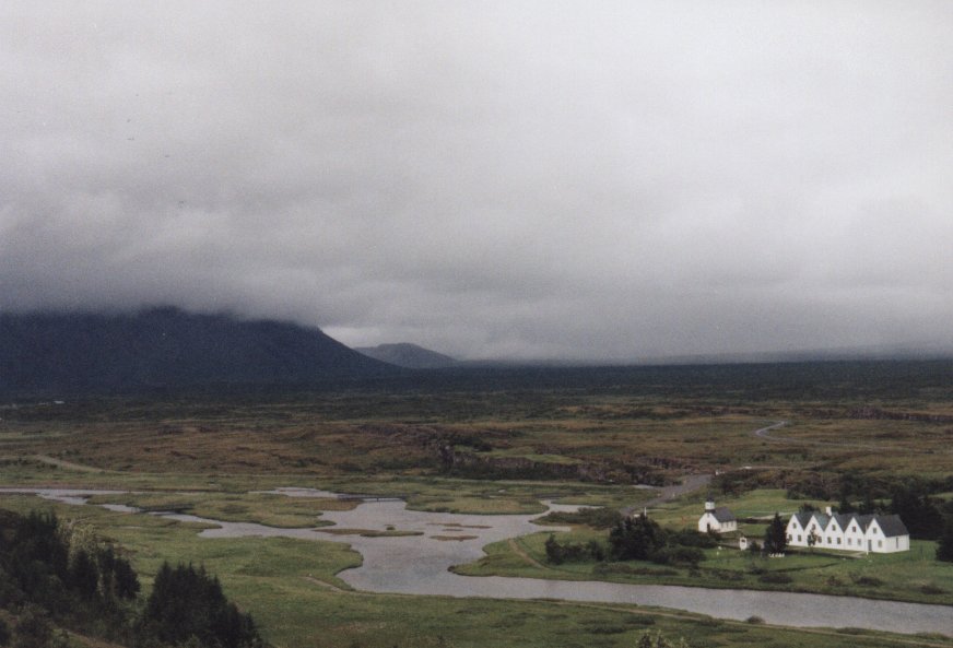
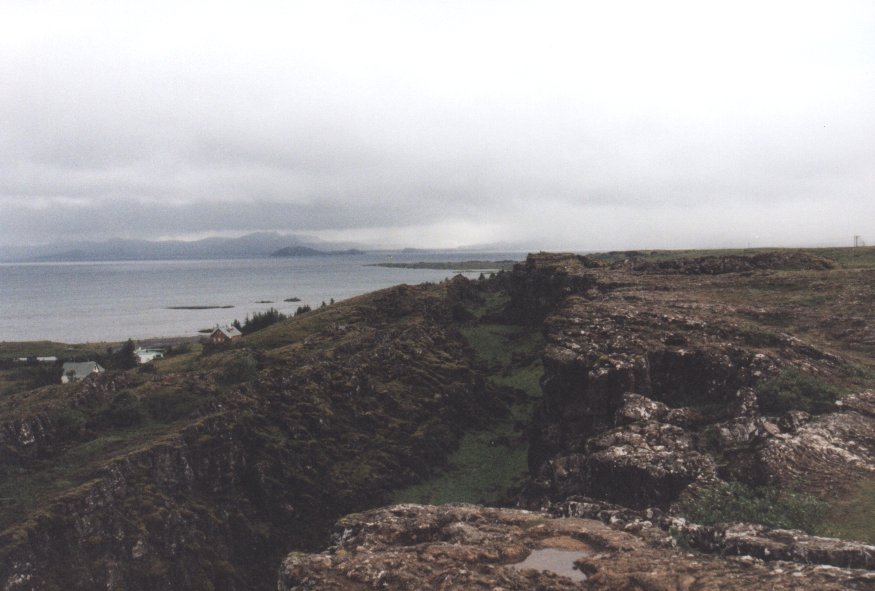
Þingvellir
"Parliament Plains", where the old parliament, the Alþingi,
was founded in 930 and met every summer for centuries. Now a national
park, it is the place of great natural grandeur and rich colour,
a vast lava plain flanked by fissures to the north of the largest
natural lake in the country, Þingvallavatn. The area is the site
of many of the most famous and crucial events and declarations in the
history of Iceland.
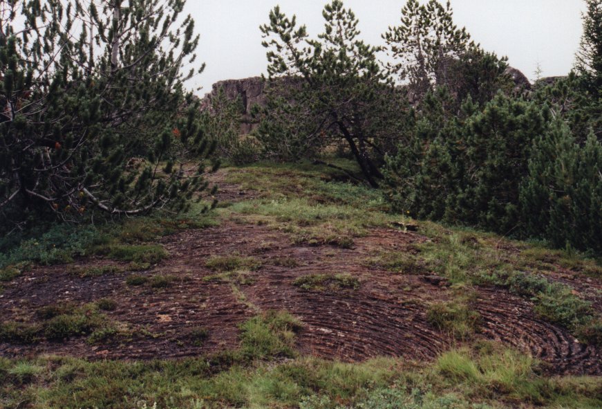
The middle picture shows what is called string lava. When the temperature of
lava goes down a thin layer on the outside becomes solid while the inside is
still melted (just like when you make hot chocolate). Sometimes the melted
stuff still moves around and this causes the rimpeling effect on the outside.
It looks a bit like little strings, that's why they call it string lava.
The right picture shows another site where you can see two tectonic plates.
Reykjavík
The last day I spend in Reykjavík. I don't know anything about the
city during the day, because on the last day I made a trip to the
Mýrdalsjökull to ride on a snow mobile. But I do know
Reykjavík during the night. The best day to go out is on
Friday. Starting at 11 o'clock pm the inner city comes alive. There are
good places to have fun (good music, nice people), but keep in mind
that a beer will cost you about 500 kroner. Yes, about 10 dollar
for a beer! And still you will find drunk people. Amazing. The bars
close around 3 o'clock am.
This document was last updated on 06/08/00